PM2.5
DATASET DESCRIPTION
Daily UK PM2.5 estimates for 2003–2021 are drawn from the Long-term Gap-free High-resolution Air Pollutants concentration dataset, version 2 (LGHAP v2). PM2.5 refers to ambient particles with an aerodynamic diameter of 2.5 μm or less; concentrations are expressed in μg/m³. The global source product covers 2000–2021 at a nominal resolution of 1 km.
LGHAP v2 combines satellite observations, ground monitoring measurements and numerical model outputs. It reconstructs gaps in satellite aerosol optical depth (AOD) and estimates PM2.5 using the SCene-Aware ensemble learning Graph ATtention network (SCAGAT). The resulting grids contain model estimates, not measurements taken at every location. Bai et al. (2024) describe the method and its validation.
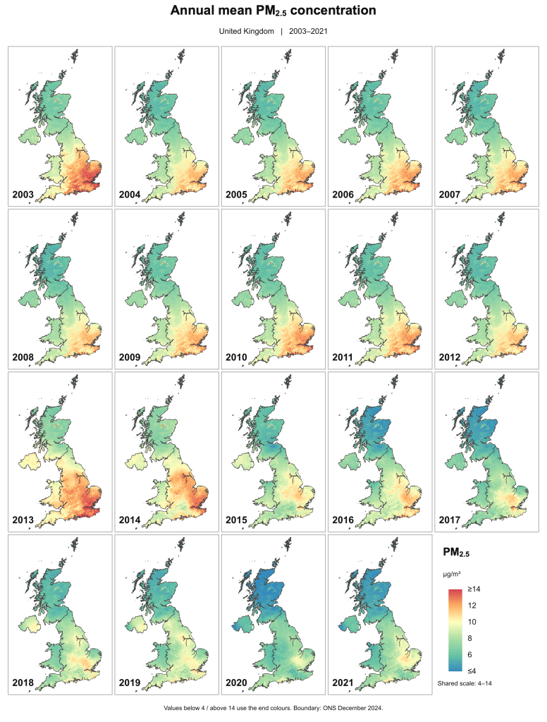
Annual maps were calculated in R from the daily GeoTIFF rasters. At each grid cell, the arithmetic mean was taken over the available daily values within the calendar year, omitting missing values. The maps retain the spatial distribution of annual mean concentration across the UK.
Bai, K., Li, K., Shao, L., Li, X., Liu C., Li, Z., Ma, M., Han, D., Sun, Y., Zheng, Z., Li, R., Chang, B., Guo, J. (2024) LGHAP v2: a global gap-free aerosol optical depth and PM2.5 concentration dataset since 2000 derived via big Earth data analytics. Earth System Science Data, 16, 2425–2448. https://doi.org/10.5194/essd-16-2425-2024.
DATA SOURCE
| Data Sources: LGHAP v2 |
| Geographic Coverage: United Kingdom |
| Coordinate System: OSGB36 / British National Grid (inspected UK sample) |
| Source Spatial Resolution: 1 km nominal; inspected UK raster cells: 633 × 1,110 m |
| Data Preparation Date: September 2026 |
| Data Format: GeoTIFF |
| Sampling Frequency of Data: Daily |
| Years Available: 2003–2021 |
VARIABLES
- Daily PM2.5 concentration and derived annual mean concentration (μg/m³)
CONTACT
- UK Dataset Prepared By: Bocheng Zhu
- Email: bocheng.zhu@mail.utoronto.ca
- Affiliated Organization: Ge-iSEE Lab, University of Toronto, Ontario, Canada