Sunlight Intensity
DATASET DESCRIPTION
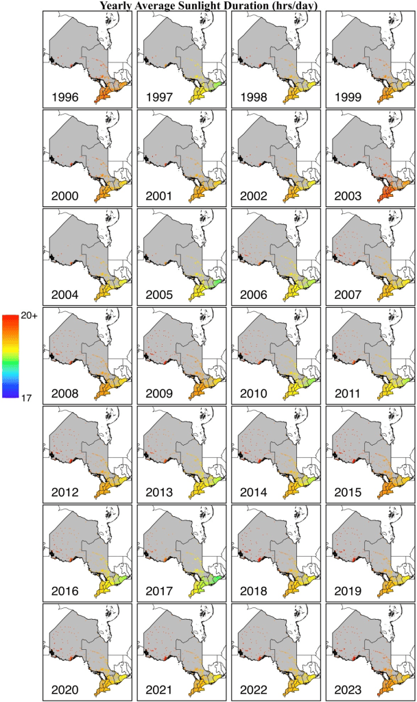
The daily sunlight intensity (surface downward solar radiation) over Ontario is provided from 1996 to 2023 in full-coverage gridded map with two spatial resolution (0.01° x 0.01° and 0.1° x 0.1°). The data, sourced from the ERA5-Land reanalysis dataset, are derived from a combination of model outputs and global observations.
Sunlight intensity data are critical for understanding solar energy availability, ecosystem health, and human activities such as agriculture and outdoor work. The intensity of solar radiation impacts daily temperatures and can significantly influence climate studies and renewable energy projects.
The accuracy of the ERA5 sunlight intensity data is validated in Muñoz-Sabater et al. (2021).
Muñoz-Sabater, J., Dutra, E., Agustí-Panareda, A., Albergel, C., Arduini, G., Balsamo, G., Boussetta, S., Choulga, M., Harrigan, S., Hersbach, H., Martens, B., Miralles, D. G., Piles, M., Rodríguez-Fernández, N. J., Zsoter, E., Buontempo, C., and Thépaut, J.-N.: ERA5-Land: a state-of-the-art global reanalysis dataset for land applications, Earth Syst. Sci. Data, 13, 4349–4383, https://doi.org/10.5194/essd-13-4349-2021, 2021.
DATA SOURCE
| Data Sources: 41.7 – 56.9N, 74.3-95.2W |
| Coordinate System: GCS_WGS84 – EPSG:4326 |
| Spatial Resolution: 0.01° x 0.01° |
| Data Preparation Date: August 2023 |
| Data Format: in GeoTIFF |
| Sampling Frequency of Data: Daily |
| Years Available: 1996 to 2023 |
VARIABLES
- Daily average sunlight intensity (hrs / day)
- Postal codes
CONTACT
- Dataset Creator: Zang Zou
- Email: joey.zang@mail.utoronto.ca
- Affiliated Organization: Ge-iSEE Lab, University of Toronto, Ontario, Canada