Daily Mean Sulfur Dioxide (SO2)
DATASET DESCRIPTION
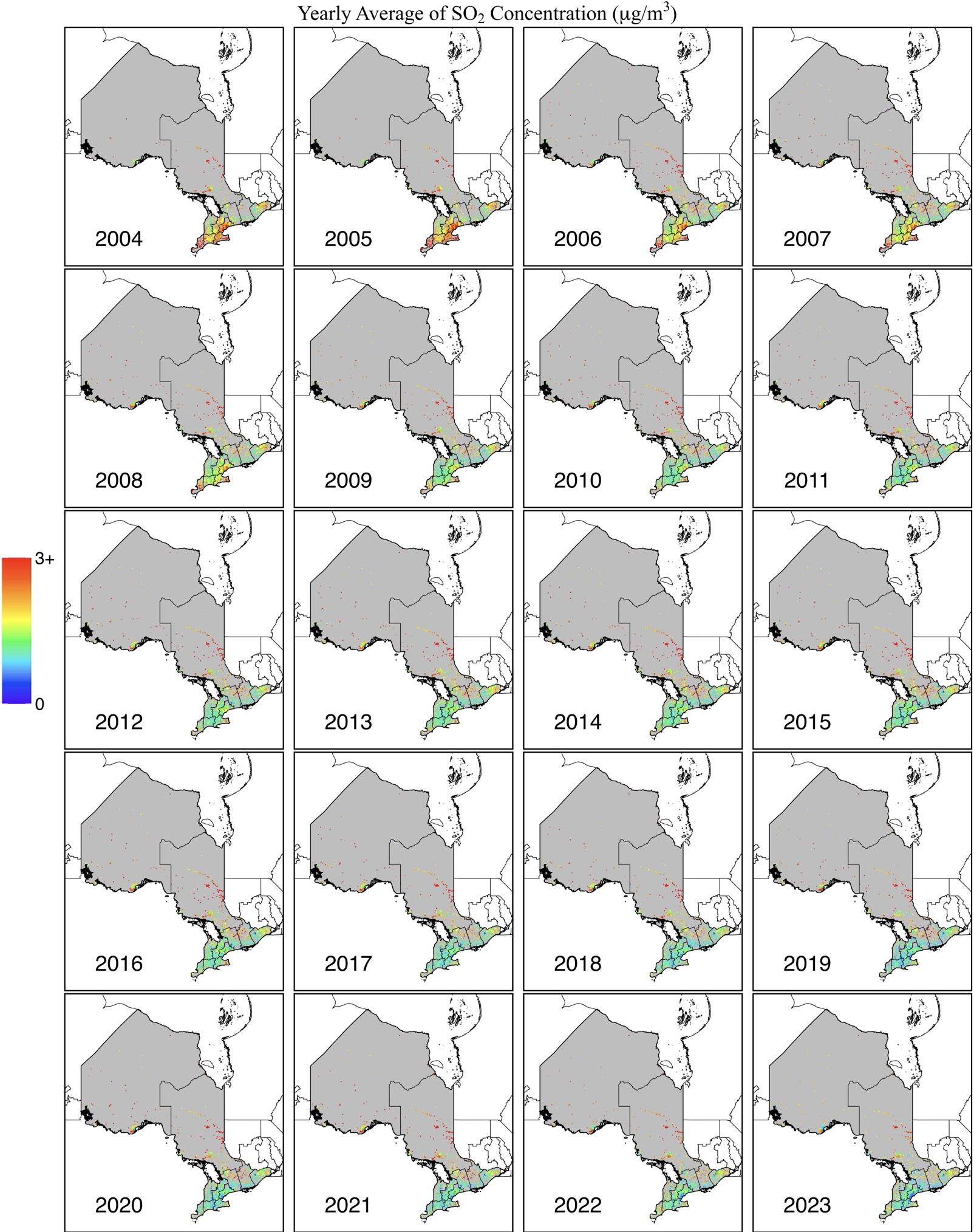
Sulfur Dioxide (SO2) concentrations over Ontario are now provided at a daily scale through a full-coverage 0.1° x 0.1° gridded map, spanning from 2004 to 2023. The SO2 dataset was developed using two trusted reanalysis datasets: EAC4 and MERRA-2. Meteorological data from ERA5-land, along with ground-based measurements, were used to train the Light Gradient-Boosting Machine, enhancing the accuracy of SO2 estimates. To compensate for the limited ground-based SO2 monitoring stations in Ontario, the model incorporated SO2 data from nearby areas to provide an initial estimate for the region. The model also utilized rich spatiotemporal data from surrounding grids and previous or subsequent days to improve the overall accuracy of the SO2 concentration predictions.
DATA SOURCE
| Data Sources: 41.7 – 56.9N, 74.3-95.2W |
| Coordinate System: GCS_WGS84 – EPSG:4326 |
| Spatial Resolution: 0.1° x 0.1° |
| Data Preparation Date: August 2023 |
| Data Format: in NetCDF |
| Sampling Frequency of Data: Daily |
| Years Available: 2004 to 2023 |
VARIABLES
- Daily average SO2 concentration in micrograms per cubic meter (μg/m3)
- Postal codes
CONTACT
- Dataset Creator: Yi Zhang
- Email: yiy.zhang@mail.utoronto.ca
- Affiliated Organization: Ge-iSEE Lab, University of Toronto, Ontario, Canada